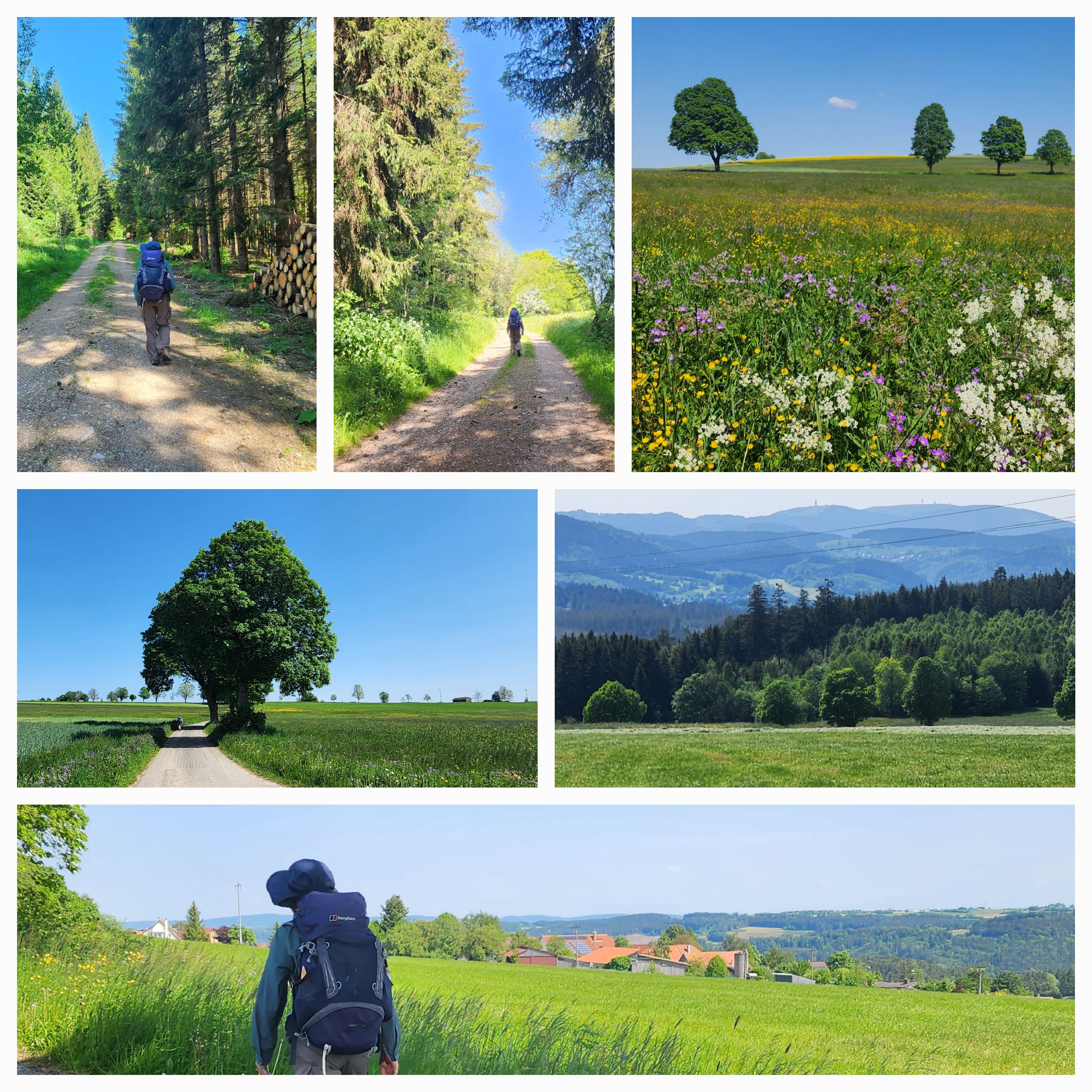
The Freiburg to Bodensee Querweg is a long-distance path which crosses the southern Black Forest from Freiburg to Konstanz. We have been on parts of it over the last couple of days, and followed its course for most of today's walk. We started with a stroll by the lake at Titisee before climbing up to Hochfirst. At 1190 metres above sea level it is the highest point of our path through Germany, and the highest point of our trip so far.
 |
| The lake at Titisee |
 |
| We strolled by the lake before climbing out of Titisee |
 |
| The first few kilometres were up |
 |
| Above Titisee - just a bit more climbing to go |
 |
| At the Hochfirst - the highest point of our trip so far |
 |
| Hochfirst |
From the Hochfirst it was a long downhill, first through the forest and then through open country, to the village of Kappel. There were several other walkers on this stretch, as well as a few bike riders.
 |
| The path went downhill through the forest. |
 |
| This memorial to the victims of a 1799 conflict between the French and the Austrians was at the side of the path |
 |
| The path opened up to some wonderful long-distance views |
 |
| The Querweg above Kappel. This stretch is also part of a major European long-distance path, the E1, which goes from North Cape in Norway down to Italy. |
 |
| We came across several other walkers along the path |
 |
| We weren't sure whether any eating establishments would be open today (many are closed for the public holiday), but this place in Kappel was. We had a break for lunch there. |
From Kappel the path descends to the Wutach Gorge (Wutachschlucht), and follows it along its course. It is a very popular area with German walkers, and we encountered many during the 4 or 5 kilometre stretch that we walked today. Some were resting, most were coming the other way, and a few overtook us.
 |
| Down to the Wutachschlucht |
 |
| We were overtaken by a couple of walkers who were a bit faster than us. We are slow travellers. |
 |
| We continued at our own pace down to the gorge |
 |
| Walking the Querweg by the Wutach Gorge |
 |
| The path went up and down. Sometimes, as here, it followed the level of the river. At other times it rose well above it. |
 |
| Walking the Wutach Gorge |
We are staying tonight in the village of Göschweiler, a couple of kilometres from the Querweg. We left the path and navigated to our accommodation.
 |
| Scenes on the way to Göschweiler |
 |
| Nearing the end of a short but enjoyable day's walk |
 |
| Day 43 - Birds |
 |
| Day 43 - Elevation Profile |
 |
| Day 43 - Route |
Day: 43
Distance: 20.62 km
Walking time: 4 hrs 36 mins
Elevation gain: 684 metres
Cumulative distance: 951.76


No comments:
Post a Comment