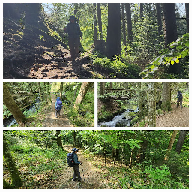
We had a very short walk today, almost a rest day, along well-marked paths through the Ravenna Gorge and Hinterzarten to Titisee. We headed downhill out of Breitnau and soon found ourselves in a forest. This was what we were expecting, as we are in the Black Forest region, and will be for a few days.
 |
| We set off from Breitnau along a well-marked path |
 |
| We were going downhill towards the forest |
 |
| We stopped on the way to take a photo of a cow with a bell. We are expecting to see many of these in Switzerland. |
 |
| We were soon in the forest |
The path took us down to the Ravenna Gorge, where a sign advised us that the path could be dangerous and that entry was at our own risk. The walk through the Gorge was like a typical Australian bushwalking path.
 |
| We walked through the forest towards Ravenna Gorge |
 |
| A sign at the entrance to the gorge warned us of danger in unfavourable conditions |
 |
| Fortunately, the conditions were favourable today |
 |
| And our walk through the Ravenna Gorge was one of the highlights of the day |
 |
| Walking the Ravenna Gorge |
It was just a short walk further on to the village of Hinterzarten, where we stocked up on supplies for the next few days. The supermarket there closed at 12 o'clock today, and most shops will be shut tomorrow for a public holiday. May is a big month for public holidays - France has 4 during the month, while Germany has 3 (they don't celebrate Victory in Europe Day). From Hinterzarten it was on to Titisee, still on well-marked trails.
 |
| On to Hinterzarten. There were now many more walkers on the path. |
 |
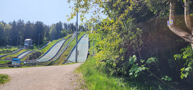
| Just past Hinterzarten, we came across this ski jump complex |
 |
| And another of those wheelchair camino signs |
 |
| We stopped to take a photo of the complex before moving on |
 |
| A photo of the complex |
 |
| On to Titisee |
We checked in to our accommodation after the shortest day's walk of our trip so far. Titisee is a popular German tourist destination, and the tourists were out in force on this holiday long weekend. We joined them to stroll around the town, sample the local delicacy (a black forest cherry cake - Schwarzwaldkirschtorte), and admire the lakeside scenery.
 |
| Tourists out in force in Titisee. The queue in the bottom picture is for the ice cream stall. |
 |
| Titisee late in the afternoon |
 |
| Black Forest Cherry Cake in the Black Forest |
 |
| Day 42 - Birds |
 |
| Day 42 - Elevation Profile |
 |
| Day 42 - Route |
Day: 42
Distance: 11.06 km
Walking time: 2 hrs 18 mins
Elevation gain: 204 metres
Cumulative distance: 931.14


No comments:
Post a Comment