Today we walked up from Freiburg into the Black Forest. It was a relatively short walk, with a bit of climbing, on a variety of surfaces. We walked on bike paths, roads, walking paths, paths that were supposed to be walking paths but were more like untrodden wilderness, and even, late in the day, a wheelchair camino path.
 |
A Camino wheelchair path sign. There was no chance of getting a wheelchair through some of the paths we took today.
|
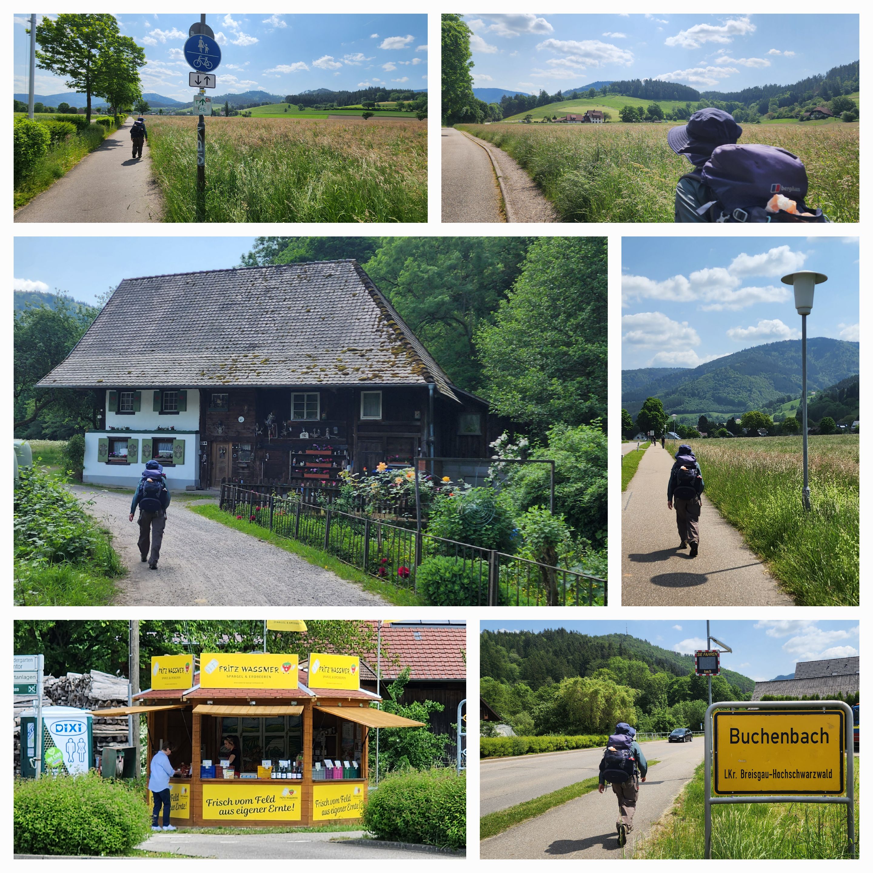
The day started with an 8 kilometre walk along a well-marked cycleway to Kirchzarten. We stopped there to stock up on supplies for lunch, and to take in some refreshment, before moving on.
 |
| Walking on the bike path to Kirchzarten. Yes, the lady with the pram did overtake us. We are slow travellers. |
 |
| Kirchzarten. A walking path sign, a stork on a church, and people out enjoying a sunny Saturday morning. |
We stayed on the cycle path another few kilometres to the village of Buchenbach. We shared the path with a few other walkers, lots of cyclists, and some children riding ponies.
 |
| On to Buchenbach. The stall was selling strawberries and asparagus. |
At Buchenbach we turned off the cycleway to take a road, which turned into a farm track. It was the route Google Maps recommended we take to get to Breitnau, the village where we are spending the night. (Yes, we should have known better). The path is also clearly marked on the local walking maps. It started well enough, as a paved road going upward (we were going upward for most of the day), with houses and farm animals by the side of the road.
 |
| Is this our turn-off? |
 |
| Yes, this walking path goes to Breitnau |
 |
| The path towards Breitnau was quite scenic, and well-signposted at the beginning. |
With the end of the tarred road, the path that was supposed to run alongside the creek quickly disappeared. We were in the middle of the forest, and our GPS showed us to be on a path. But there was no path.
 |
| Not the sort of path we were expecting |
 |
| Not a path at all, really. |
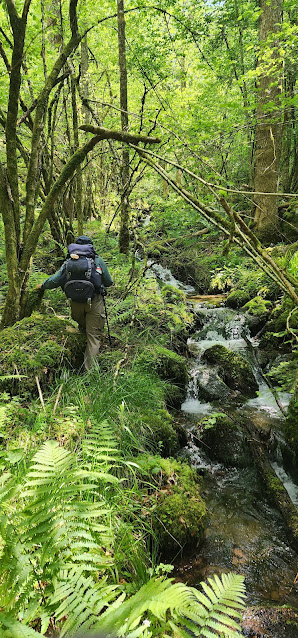 |
| In the end, we just followed the creek upstream. |
 |
| It was a pretty walk, once we stopped looking for a path. |
 |
| There wasn't much evidence of anyone else having walked this way recently. |
 |
| The going was a bit tricky at times. |
 |
| Well, for most of the way, actually |
Anyway, by following the creek we eventually emerged on the road where the maps indicated the path should come out. Then we headed up a series of "wheeled tracks" that sounded safe enough and were to take us onwards towards Breitnau.
 |
| Actually, these paths weren't too bad. Overgrown in places, with trees and blackberry bushes growing in the middle of the path, but not too bad. |
We came out onto an open area with wonderful forest and farmland views. We were only a couple of kilometres from Breitnau now, and made our way into the village via a road that was marked as a wheelchair-accessible Camino path.
 |
The meandering road that took us into Breitnau.
|
After such an adventuresome day's walk, we have decided to try to keep to more mainstream paths for the rest of our time in Germany.
 |
| A fun adventure, but one that we're in no hurry to repeat. |
 |
| Day 41 - Birds |
 |
| Day 41 - Elevation Profile |
 |
| Day 41 - Route |
Day: 41
Distance: 21.74 km
Walking time: 4 hrs 52 mins
Elevation gain: 864 metres
Cumulative distance: 920.08


No healthy fruit???
ReplyDeleteWe do eat healthy fruit every day, but not necessarily in the same form as in France. There will be a chocolate challenge in Switzerland however!
ReplyDelete