 |
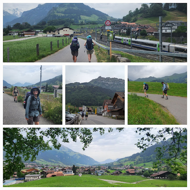
| Leaving Spiez at the start of a long day's walk |
Today's walk was a long stretch from Spiez to Kandersteg. It was uphill for most of the way, although we started by retracing our steps around Lake Thun to Faulensee.
 |
| Leaving Spiez the way we had come in yesterday - on the path by Lake Thun |
 |
| Back to Faulensee along the lake |
We left the lake at Faulensee to head inwards and upwards, through the town, through a forest, over a hill and into the village of Aeschi bei Spiez.
 |
| From Faulensee to Aeschi - a bit of climbing involved |
We found another path at Aeschi to take us down to the Kander River at Mülenen. From there we picked up a riverside path to take us into Frutigen.
 |
| From Mülenen to Frutigen along the Kander |
We were now over half way into the day's walk. We stopped for lunch in Frutigen, but didn't linger. There were still 14 kilometres to cover in the afternoon, and storms were predicted, so we were keen to keep going.
 |
| Moving on through Frutigen |
We were following a marked path to Kandersteg, where we are staying the night. It led us up past the ruined Tellenburg Castle, and on up the valley to Kandergrund and Blausee. By now the rain had started and the wet weather gear was out.
 |
| Tellenburg castle and beyond |
 |
| And then the rain came. |
We walked through Kandergrund in the rain and headed for Blausee. Vision was reduced due to the weather, and the view of the snow-capped mountains disappeared for a while.
 |
| In the rain towards Kandersteg |
 |
| It was raining when we passed by Kandergrund |
 |
| The rain continued as we pressed on uphill |
 |
| The path took us across a meadow |
 |
| And past a church |
 |
| More uphill in the rain |
 |
| The sky eventually cleared, temporarily at least |
We managed a few kilometres before the heavens opened and we were hit with a storm. There was lightning and thunder, and a fair amount of rain.
 |
| It was dry when we had a chocolate stop at Blausee. |
 |
| But the rain started again soon afterwards, and didn't stop until after our arrival in Kandersteg |
With lightning around, we walked the final 5 kilometres or so fairly briskly, checked in to our accommodation, and started to dry off.
 |
| A rainy end to a long day's walk |
 |
| Approaching Kandersteg in the rain |
 |
| Kandersteg was wet |
 |
| Kandersteg attracts lots of walkers. It looked like this lot might have been caught in the storm like us. |
 |
| The weather was clearing as we made our way to our accommodation |
 |
| Day 67 - Birds |
 |
| Day 67 - Elevation Profile |
 |
| Day 67 - Route |
Day: 67
Distance: 30.8 km
Walking time: 6 hrs 21 mins
Elevation gain: 1,084 metres
Cumulative distance: 1,457.24
Switzerland distance: 378.44
Switzerland chocolate consumption: 26 blocks
Poem of the Day:
VALLEY WALKING
We are walking through the valley into
Kandersteg
Following the yellow diamonds of the
wanderweg
Walking through the valley is like
walking by the lake
Any feelings of flatness are fake
There is quite a bit of altitude
And just when you think you've
accrued
Enough Up
Nup!
Deluded conclusion
Displeasing illusion
Dude,
That was just a prelude


No comments:
Post a Comment