Wednesday 31 May 2023

DAY 45 - OPFERDINGEN to ENGEN (Wednesday 31 May)

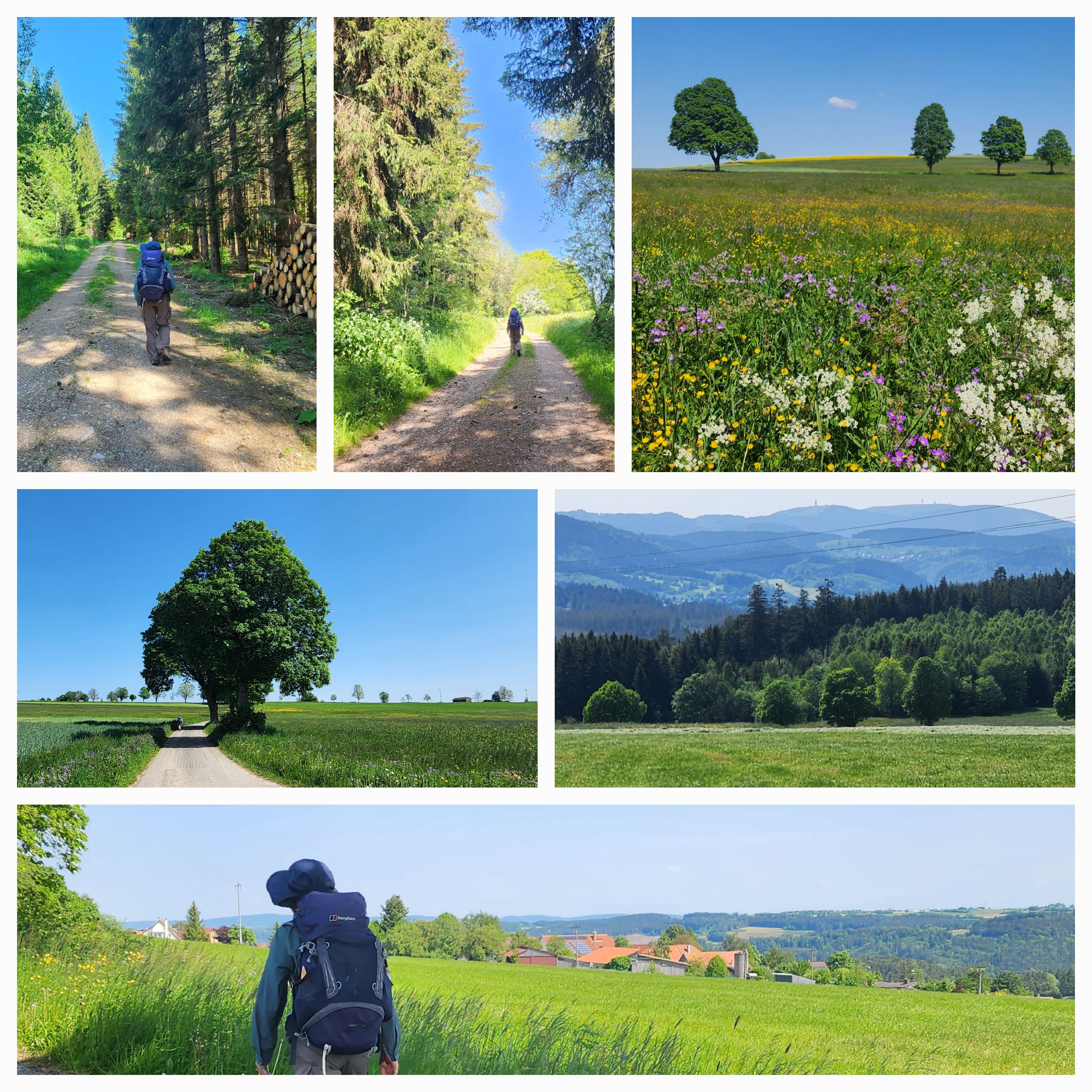
Our journey through southern Germany continued with a longer walk on bike paths, quiet roads and walking tracks, culminating in our rejoining the Freiburg to Konstanz Querweg for the last few kilometres into Engen. We started by following a cycle route from Opferdingen through the villages of Riedböhringen and Hondingen. There was minimal traffic, the sun was shining, and the going was good. 
Heading out from Opferdingen for the day's walk
A relaxed start to the day's walking
Coming into Hondingen
A local lad going about his business in Hondingen
The next several kilometres were on a bike path that largely followed a railway line. There were several cyclists and a few other walkers using the path. 
We weren't the only one enjoying the sunny day on the bike path
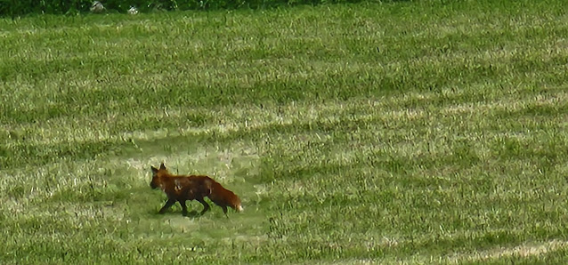
We saw a fox in a field below us.
We had our picnic lunch stop in the village of Leipferdingen, then left the cycle route to join a walking path up to Napoleonseck. 
Leipferdingen
Walking on to Napoleonseck 
Napoleonseck is a viewpoint where soldiers from the French army had a lookout prior to the Battle of Engen in 1800. The view is largely over the volcanic region of Hegau. At this point, we rejoined the Querweg that we had been on at times over the last few days. 
Napoleonseck
On towards Engen on the Querweg
Shortly after leaving Napoleonseck, we reached the 1,000 kilometre mark of our trip. We marked the occasion in the traditional way - with a ceremonial selfie. 
1,000 kilometres on foot since leaving Dieppe 
The last few kilometres into Engen were largely downhill. On the way down we passed a memorial to those who lost their lives in the Battle of Engen in 1800. 
On to Engen
After settling in to our accommodation and attending to dinner,  we strolled around Engen's medieval old town. 
We attended to dinner
We had time for some sightseeing in the medieval old town before retiring for the night
Day 45 - Birds 
Day 45 - Elevation Profile 
Day 45 - Route 
Day: 45
Distance: 29.13 km
Walking time: 6 hrs 05 mins
Elevation gain: 652 metres
Cumulative distance:  1,005.50

Tuesday 30 May 2023

DAY 44 - GÖSCHWEILER to OPFERDINGEN (Tuesday 30 May)

Most of today's walk was a pleasant bushwalk on the well-marked Querweg alongside the Wutach Gorge. To get there, we followed the walking path signs from Göschweiler, our overnight stop. 

The path out of  Göschweiler was quite clear, at least at the beginning
When we appeared to be walking through a meadow we checked our maps to reassure ourselves that we were still on the path
Apparently we were
Although it didn't always seem that way
Checking the maps again.  Yes,  we were still on the path
Advancing along the walking path
Emerging on to a larger trail, we still weren't sure
But the signpost pointing back the way we had come confirmed that we had been on the right track. We are getting used to the idea that some of these German walking paths are a bit different to the ones we have at home. 
We eventually made it down to the Querweg (the Freiburg to Konstanz path we had walked along yesterday), and followed it for about 13 kilometres eastwards alongside the Wutach Gorge. This path was well-signposted, with spectacular views at times. There were many people of all ages walking along the path, some with large backpacks like ours, some with day packs,  and some with just the clothes they had on. 
Going down to the Wutach Gorge 
 The path along the gorge was largely well maintained, but we did sometimes have to watch where we were putting our feet
There were some interesting bridges to cross
And a couple of waterfalls for those classic waterfall selfie shots
In some places the cliffs went down to the waters edge. There were many sections where the path was quite narrow, whether hugging the cliffs by the water's edge, or rising to a level where progress was possible. 
Walking the Wutach Gorge 
Wutach Gorge 
A pleasant walk by the river
An Australian long-distance walker braving the icy water for a bit of a paddle
When it was time to leave the gorge, we just had to make our way to the village where we are staying tonight. Our maps showed that there was a walking path heading in the right direction. 
The path was even marked as a Camino. It took us up through the forest, before emerging onto more open countryside. 
We walked into the village of Mundelfingen, where we were able to buy fresh milk and dinner supplies at a self-service establishment. It was then only a few more kilometres on a quiet road on to Opferdingen, where we are staying the night. 
Milchhisli in Mundelfingen - source of fresh milk and dinner supplies for long-distance Australian walkers 
The last 3 kilometres - a scenic road from Mundelfingen to Opferdingen 
Day 44 - Birds 
Day 44 - Elevation Profile 
Day 44 - Route 
Day: 44
Distance: 24.61 km
Walking time: 5 hrs 43 mins
Elevation gain: 662 metres
Cumulative distance:  976.37

Monday 29 May 2023

DAY 43 - TITISEE to GÖSCHWEILER (Monday 29 May)

The Freiburg to Bodensee Querweg is a long-distance path which crosses the southern Black Forest from Freiburg to Konstanz. We have been on parts of it over the last couple of days, and followed its course for most of today's walk. We started with a stroll by the lake at Titisee before climbing up to Hochfirst. At 1190 metres above sea level it is the highest point of our path through Germany, and the highest point of our trip so far. 
The lake at Titisee
 We strolled by the lake before climbing out of  Titisee
The first few kilometres were up
Above Titisee - just a bit more climbing to go
At the Hochfirst - the highest point of our trip so far
Hochfirst 
From the Hochfirst it was a long downhill, first through the forest and then through open country, to the village of Kappel. There were several other walkers on this stretch, as well as a few bike riders. 
 The path went downhill through the forest. 
This memorial to the victims of a 1799 conflict between the French and the Austrians was at the side of the path
The path opened up to some wonderful long-distance views
The Querweg above Kappel. This stretch is also part of a major European long-distance path, the E1, which goes from North Cape in Norway down to Italy. 
We came across several other walkers along the path
We weren't sure whether any eating establishments would be open today (many are closed for the public holiday), but this place in Kappel was. We had a break for lunch there. 
From Kappel the path descends to the Wutach Gorge (Wutachschlucht), and follows it along its course. It is a very popular area with German walkers, and we encountered many during the 4 or 5 kilometre stretch that we walked today. Some were resting, most were coming the other way, and a few overtook us. 
Down to the Wutachschlucht
We were overtaken by a couple of walkers who were a bit faster than us. We are slow travellers. 
We continued at our own pace down to the gorge
Walking the Querweg by the Wutach Gorge
The path went up and down. Sometimes, as here, it followed the level of the river. At other times it rose well above it. 
Walking the Wutach Gorge
We are staying tonight in the village of Göschweiler, a couple of kilometres from the Querweg. We left the path and navigated to our accommodation. 
Scenes on the way to Göschweiler 
Nearing the end of a short but enjoyable day's walk
Day 43 - Birds
Day 43 - Elevation Profile 
Day 43 - Route 
Day: 43
Distance: 20.62 km
Walking time: 4 hrs 36 mins
Elevation gain: 684 metres
Cumulative distance:  951.76

DAY 80 - BOSSEY to GENEVA (Wednesday 5 July)

On the final day of our walk, we followed the Chemin de St Jacques south to Geneva, then went on to the water jet for the traditional end-of...