 |
| A long day's walk ahead |
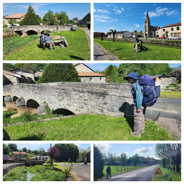
We had a long day's walk ahead of us when we set out from Ligny-en-Barrois this morning. It started with a few kilometres along the Canal de la Marne au Rhin.
 |
| A few kilometres along the canal |
We turned off the canal at the village of Longeaux. We made a small detour to inspect the fortified church in the village, and observed some of the village's other features on the way through.
 |
| Some features of Longeaux - 3 working fountains and a community book box |
 |
| Another feature of Longeaux - the lavoir, or communal washing house |
 |
| Fortified church at Longeaux |
We spent the next part of the day on a country road going up and down through farmland and among quiet villages. We stopped in one of them, Biencourt-sur-Orge, for some healthy fruit.
 |
| Walking on a quiet country road - the D127 to Biencourt-sur-Orge |
 |
| Biencourt-sur-Orge - a fine place for a rest stop |
From Biencourt-sur-Orge we picked up the GR714, a long-distance walking path that took us about 10kms to the village of Bonnet. The path went through a section of forest before emerging among a windfarm plantation.
 |
| The GR714 - we stayed on the path towards Bonnet, not diverging to the right or the left |
 |
| The GR714 took us up close to some wind turbines. The sign warns of falling ice from the blades |
 |
| Bonnet has a largely intact lavoir from the nineteenth century |
We had our picnic lunch in Bonnet, before continuing on another country road to our evening's destination of Gondrecourt-le-Château.
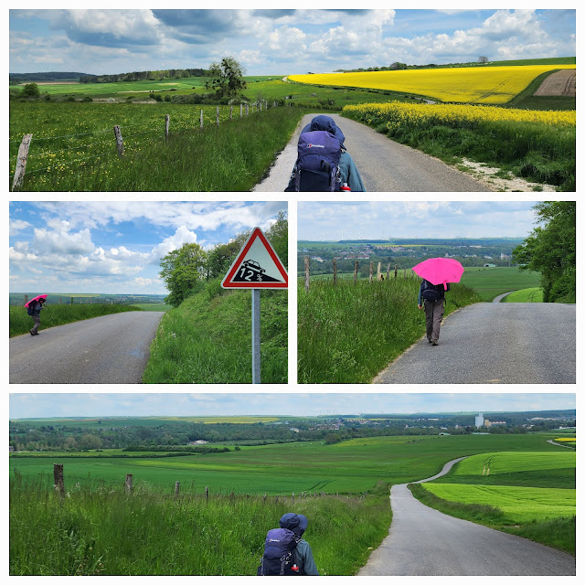 |
| Another quiet country road - the D182 from Bonnet to Gondrecourt-le-Château |
Arriving in Gondrecourt, we were surprised to find a very pleasant townscape along the river, complete with another lavoir.
 |
| Gondrecourt-le-Château - a historic town with an attractive riverside area |
 |
| Day 27 - Healthy Fruit |
 |
| Day 27 - Birds |
 |
| Day 27 - Elevation Profile |
 |
| Day 27 - Route |
Day: 27
Distance: 32.5 km
Walking time: 6 hrs 35 mins
Elevation gain: 566 metres
Cumulative distance: 617.72 km


No comments:
Post a Comment