Sunday, 30 April 2023

DAY 14 - LA FÈRE to LAON (Sunday 30 April)

For the first time in a while, we did not follow a river or a canal at all in today's walk. We started off with a brisk 10 kilometre section on the road from La Fère to St-Nicolas-aux-Bois. We quite enjoyed being able to stride out on the undulating terrain.
Striding out through the undulating countryside
Walking towards St-Nicolas-aux-Bois 
Racing past the sign asking people to slow down
After a welcome rest for morning tea, we continued on our way. We soon joined the GR145, which we followed for most of the way into Laon. The path was well signposted all the way. 
Rest stop in St-Nicolas-aux-Bois 
The GR145 - well signposted all the way
At one point we were approached by a trio of friendly French walkers who were out for a stroll in the woods. They engaged us in conversation for a while, and before moving on, took us into the forest to show us an old oak tree that was on a register of significant old trees. 
A trio of friendly French walkers
A large oak in the forest. Our new friend is either hugging it, or demonstrating the width of its circumference
Going where the path takes us
We stopped for lunch at a conveniently-placed bench in Cessières-Suzy, before continuing on the GR145. As the old town of Laon is perched on top of a hill, we had a good view of it as we approached. 
Coming into Cessières-Suzy
Perhaps starting to tire
A bench is always a welcome sight around lunchtime
On to Laon after lunch. We do enjoy our puddle photography. 
Heading towards Laon, up on the hill ahead
German military ceremony, on the way in to Laon. The town was occupied by the Germans during World War I. 
We left the GR145 to enter Laon via the Sente Gaillot. This was a clearly- marked path which ascended with the help of a few steps up to the old town wall. We walked around the wall for a while until we reached our evening's destination. 
Climbing up the Sente Gaillot
The old town walls,  Laon 
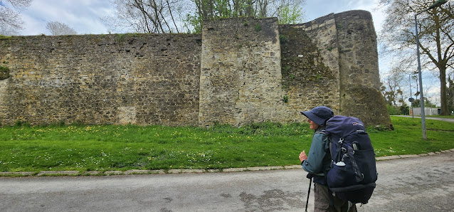
Walking around the medieval town wall,  Laon
Day 14 - Healthy Fruit
Day 14 - Birds (a bit light on again I'm afraid. Not even a great crested grebe)
Day 14 - Flowers. Because the little birds wouldn't stay still for us to photograph them, we took a few photos of flowers instead. 

Day 14 - Elevation Profile
Day 14 - Route 
Day:  14
Distance: 29.29 km
Walking time:  6 hrs 04 mins
Elevation gain: 514 metres
Cumulative distance:  343.04 km

Saturday, 29 April 2023

DAY 13 - EPPEVILLE to LA FÈRE (Saturday 29 April)

With another long day's walk in front of us, we got off to an early start. First stop was a bakery, to pick up the day's supplies. Then a short distance into Ham, where we spent a while wandering among the ruins of Ham Castle. 
The morning chore - picking up the day's supplies
This sign on the way into Ham caused us to speculate on what exactly a cultural pole might be. 
The signboard At Ham Castle explains some of its history, including Louis Napoleon's clever escape in 1846.
We wandered among the ruins, and then continued our walk
The first 10 kilometres or so were again following a canal - this time the Canal de la Somme. The walking was pleasant, with the usual items of interest, and the town of Saint-Simon provided us with the luxury of a bench (not to be taken for granted in France) for our morning tea stop. 
A pleasant walk along the canal

A welcome bench in Saint-Simon
The next part of the walk was alongside the Canal de St-Quentin. The path was overgrown in places, so the going was sometimes a bit slow. But there was still plenty to attract the attention of the passing Australian walker. 
The Canal de St-Quentin between Saint-Simon and Jussy
After another rest at another well- placed bench in Jussy, we continued on. For much of the stretch into Liez we were walking on the GR145 (Via Francigena), which we will be following on and off for the next week or so.  At Liez we had our lunch stop. 
From Jussy to Liez - mostly on the Via  Francigena
Picnic lunch at Liez
After lunch we had a rather uninspiring 7km walk along the road to La Fère, where we are staying the night. It has the appearance of a town whose better days are behind it. 
La Fère - faded signs of a brighter past
We were very impressed, however,  with this sign on the entry into La Fère - the town's name spelt out in insect hotels
Day 13 - Birds
Day 13 - Healthy Fruit
Day 13 - Elevation Profile
Day 13 - Route
Day:  13
Distance: 30.08 km
Walking time:  6 hrs 03 mins
Elevation gain: 186 metres
Cumulative distance:  313.75 km

Friday, 28 April 2023

DAY 12 - PÉRONNE to EPPEVILLE (Friday 28 April)

Today was another fairly routine day. We left our b&b after breakfast, headed to a boulangerie for the day's bread and fruit,  and hit the road. 

Australian tourist faced with a tempting breakfast
We bought the day's supplies, and headed off out of Péronne
We walked alongside the Canal du Nord for a while. There were a few barges on the canal, and a few other attractions. 
The Canal du Nord, heading south from Péronne
We spotted this classic French gastropod on the path ahead of us. 
It wasn't too long before we had caught up with it
And eventually we were forging ahead. As far as we know we managed to stay ahead of it for the rest of the day. 
The path was blocked at one stage, but we were able to walk through the construction site and continue on our way
We left the canal at Saint-Christ-Briost, and took a quiet country road a few kilometres on to Falvy, where we stopped for morning tea. 
Some highlights of Saint-Christ-Briost 
Walking on to Falvy
Fortified by our traditional healthy fruit, we continued on southwards. We were now on the GR800 again, at least for the few kilometres to our lunch stop in Offoy. 
The GR800 towards Offoy
This sign on the way in to Buny asked us to slow down. 
It was only a short walk on from Offoy to our destination at Eppeville. We settled in to our accommodation and started preparing for another fairly long day tomorrow.
Day 12 - Healthy Fruit
Day 12 - Birds (yes, a slow bird day)
Day 12 - Elevation Profile 
Day 12 - Route
Day:  12
Distance: 30.33 km
Walking time:  6 hrs 07 mins
Elevation gain: 331 metres
Cumulative distance:  283.67 km

DAY 80 - BOSSEY to GENEVA (Wednesday 5 July)

On the final day of our walk, we followed the Chemin de St Jacques south to Geneva, then went on to the water jet for the traditional end-of...